Wolverhampton Low Level Station
Introduction
The photograph on this page of Wolverhampton Low Level Station by John M as part of the Geograph project.
The Geograph project started in 2005 with the aim of publishing, organising and preserving representative images for every square kilometre of Great Britain, Ireland and the Isle of Man.

There are currently over 7.5m images from over 14,400 individuals and you can help contribute to the project by visiting https://www.geograph.org.uk
Wolverhampton Low Level Station
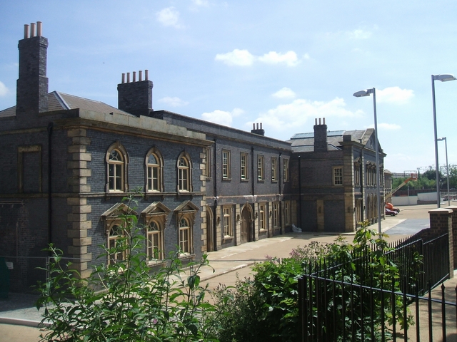
Image: © John M Taken: 26 Jul 2008
The Grade 2 listed building was opened in 1855 on the GWR lines from Birmingham Snow Hill. It was in competition with the LMS,Stour Valley, line from Birmingham New Street to the adjacent High Level Station. Electrification of the WCML in the 1960s led to a reduction and final closure of passenger services in 1972. A parcels service continued until 1981. British Rail Divisional Engineer's Department used the building until it was purchased by the town council in May 1986. It has been unused for twenty years whilst numerous schemes have come and gone for museums, heritage parks, casinos, sporting and retail developments. At long last a scheme has come to fruition!
Images are licensed for reuse under creativecommons.org/licenses/by-sa/2.0
Image Location
Latitude
52.587305
Longitude
-2.117889