Shottskirk School?
Introduction
The photograph on this page of Shottskirk School? by Jim Smillie as part of the Geograph project.
The Geograph project started in 2005 with the aim of publishing, organising and preserving representative images for every square kilometre of Great Britain, Ireland and the Isle of Man.

There are currently over 7.5m images from over 14,400 individuals and you can help contribute to the project by visiting https://www.geograph.org.uk
Shottskirk School?
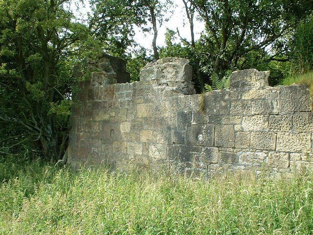
Image: © Jim Smillie Taken: 21 Jul 2008
This is all that remains of a small settlement beside Kirk O' Shotts church. An 1899 map shows there was a school. The present school, now known as Kirk o' Shotts Primary is about half a mile to the west and opened in August 1912. http://www.salsburghheritagegroup.co.uk/17.html
Images are licensed for reuse under creativecommons.org/licenses/by-sa/2.0
Image Location


Leaflet Map data © OpenStreetMap
Latitude
55.845307
Longitude
-3.848746