National Cycle Network sign, Guilford Road near Sandwich
Introduction
The photograph on this page of National Cycle Network sign, Guilford Road near Sandwich by Ian Capper as part of the Geograph project.
The Geograph project started in 2005 with the aim of publishing, organising and preserving representative images for every square kilometre of Great Britain, Ireland and the Isle of Man.

There are currently over 7.5m images from over 14,400 individuals and you can help contribute to the project by visiting https://www.geograph.org.uk
National Cycle Network sign, Guilford Road near Sandwich
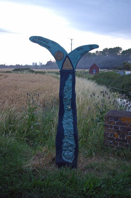
Image: © Ian Capper Taken: 22 Jul 2008
Taken just after sunset, this is the sign visible to the right of the bridge in Image Guilford Road forms part of National Cycle Network Route 1. On the right is North Stream and in the far distance are the towers of the disused Richborough power station.
Images are licensed for reuse under creativecommons.org/licenses/by-sa/2.0
Image Location
Latitude
51.26961
Longitude
1.364371