The Omagh Bypass
Introduction
The photograph on this page of The Omagh Bypass by Kenneth Allen as part of the Geograph project.
The Geograph project started in 2005 with the aim of publishing, organising and preserving representative images for every square kilometre of Great Britain, Ireland and the Isle of Man.

There are currently over 7.5m images from over 14,400 individuals and you can help contribute to the project by visiting https://www.geograph.org.uk
The Omagh Bypass
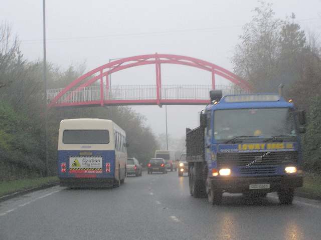
Image: © Kenneth Allen Taken: 22 Nov 2005
The footbridge over the bypass connects the Sacred Heart College to the centre of town. The bypass is presently being extended, but it will be interesting to see if the traffic situation will improve. Vehicles are often at a standstill along this route as there are too many feeder points along it leading to the town.
Images are licensed for reuse under creativecommons.org/licenses/by-sa/2.0
Image Location


Leaflet Map data © OpenStreetMap
Latitude
54.59641
Longitude
-7.305013