Bridge on the Shawl footpath
Introduction
The photograph on this page of Bridge on the Shawl footpath by Gordon Hatton as part of the Geograph project.
The Geograph project started in 2005 with the aim of publishing, organising and preserving representative images for every square kilometre of Great Britain, Ireland and the Isle of Man.

There are currently over 7.5m images from over 14,400 individuals and you can help contribute to the project by visiting https://www.geograph.org.uk
Bridge on the Shawl footpath
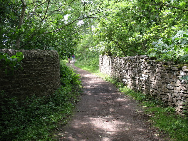
Image: © Gordon Hatton Taken: 20 Jul 2008
The photographer would be the first to admit that this isn't the best ever photo of a bridge, but to capture an image of the stone arch would involve either a 10m abseil down a rockface, or a longer route through head high nettles. [neither appealed] The bridge spans a narrow and deep cut through the limestone where once ran a railway line connecting Moor Quarry with the Wensleydale line below.
Images are licensed for reuse under creativecommons.org/licenses/by-sa/2.0
Image Location


Leaflet Map data © OpenStreetMap
Latitude
54.31261
Longitude
-1.849642