View west from The Kymin
Introduction
The photograph on this page of View west from The Kymin by Jonathan Billinger as part of the Geograph project.
The Geograph project started in 2005 with the aim of publishing, organising and preserving representative images for every square kilometre of Great Britain, Ireland and the Isle of Man.

There are currently over 7.5m images from over 14,400 individuals and you can help contribute to the project by visiting https://www.geograph.org.uk
View west from The Kymin
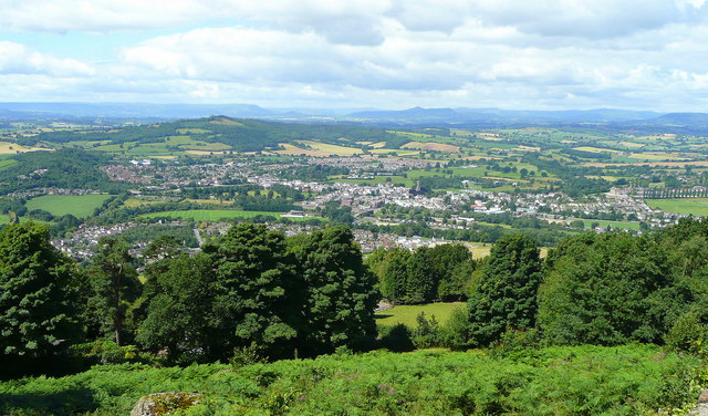
Image: © Jonathan Billinger Taken: 20 Jul 2008
In the foreground are the trees sheltering the houses on the Kymin Hill. The middle distance is taken up with the town of Monmouth spread out on a welcome patch of July sunshine. In the blue far distance are the hills around Abergavenny with Blorenge, Sugarloaf and Skirrid clear as well as Pen-y-fan and Corn Du just to the left of the Sugarloaf's cone. The Black Mountains and Hay Bluff are over to the right.
Images are licensed for reuse under creativecommons.org/licenses/by-sa/2.0
Image Location
Latitude
51.809479
Longitude
-2.688055