City Road, opposite Lovers' Lane
Introduction
The photograph on this page of City Road, opposite Lovers' Lane by Deborah Tilley as part of the Geograph project.
The Geograph project started in 2005 with the aim of publishing, organising and preserving representative images for every square kilometre of Great Britain, Ireland and the Isle of Man.

There are currently over 7.5m images from over 14,400 individuals and you can help contribute to the project by visiting https://www.geograph.org.uk
City Road, opposite Lovers' Lane
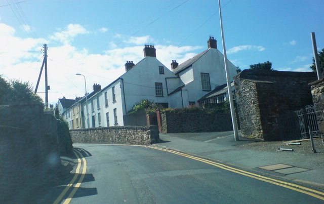
Image: © Deborah Tilley Taken: 20 Jul 2008
This little terraced house has doubled in size over the years to produce a substantial building. There is a lane opposite leading to 21,23,25 and 27 City Road. It used to be known as Lovers' Lane. I wonder why??? City Road was known as Cokey Street in bygone years and the area off Haven Road beyond now known as Cuckoo was also known as Cokey. This was obviously the road to Cokey. (Which had a garth and was also connected with the Priory) The area behind this terrace is called Castle High and is a modern housing estate. It is said that these houses are built on the graves of the poor unfortunates of Haverfordwest who died in the plague of 1665.
Images are licensed for reuse under creativecommons.org/licenses/by-sa/2.0
Image Location


Leaflet Map data © OpenStreetMap
Latitude
51.803349
Longitude
-4.974467