Broughton Crossing: The Dog House
Introduction
The photograph on this page of Broughton Crossing: The Dog House by Nigel Cox as part of the Geograph project.
The Geograph project started in 2005 with the aim of publishing, organising and preserving representative images for every square kilometre of Great Britain, Ireland and the Isle of Man.

There are currently over 7.5m images from over 14,400 individuals and you can help contribute to the project by visiting https://www.geograph.org.uk
Broughton Crossing: The Dog House
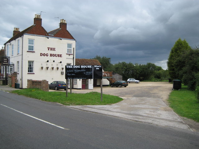
Image: © Nigel Cox Taken: 20 Jul 2008
Broughton Crossing got its name from the fact that the London & North Western Railway's Cheddington to Aylesbury branch line crossed over the road here, although there was never a station. Despite that the small community of a public house and about a dozen terraced houses grew up alongside the crossing. The railway was built as long ago as 1839, but was an early pre-Beeching casualty of closure, passenger services having been terminated in 1953 and goods in 1964. The railway ran dead straight from just outside Aylesbury to just outside Cheddington, and it ran here between the silver car and the wheelie bin on the right. The 1926 large scale Ordnance Survey map shows the northern railway boundary fence just clipping the pub outbuilding behind the black sign, while the southern boundary was the hedge on the right. The public house is now called the Dog House but all the large scale Ordnance Survey maps from 1879 through to 1952 all show it as The Prince of Wales. According to the blackboard the pub also offers en suite accommodation and is the 2008 Good Food Guide. Call 01296 485228 for details...!
Images are licensed for reuse under creativecommons.org/licenses/by-sa/2.0
Image Location
Latitude
51.824248
Longitude
-0.781727