2008 : Flush Bracket on the trigpoint on High Barrow Hill, Southdown
Introduction
The photograph on this page of 2008 : Flush Bracket on the trigpoint on High Barrow Hill, Southdown by Maurice Pullin as part of the Geograph project.
The Geograph project started in 2005 with the aim of publishing, organising and preserving representative images for every square kilometre of Great Britain, Ireland and the Isle of Man.

There are currently over 7.5m images from over 14,400 individuals and you can help contribute to the project by visiting https://www.geograph.org.uk
2008 : Flush Bracket on the trigpoint on High Barrow Hill, Southdown
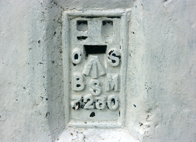
Image: © Maurice Pullin Taken: 14 Jul 2008
My Geographia plan of the City of Bath names this site "High Barrow Hill" while OS Explorer 155 has the name "Southdown" printed over it. The reference number TP6624, was allocated by the T:UK website http://www.trigpointinguk.com/ because they did not have access to the official numbers at the time. The number on the identification plate attached to the pillar, which is the official number(!) is S3230. Information supplied by Barry Hunter.
Images are licensed for reuse under creativecommons.org/licenses/by-sa/2.0
Image Location
Latitude
51.36827
Longitude
-2.396276