Hoyle House
Introduction
The photograph on this page of Hoyle House by John Illingworth as part of the Geograph project.
The Geograph project started in 2005 with the aim of publishing, organising and preserving representative images for every square kilometre of Great Britain, Ireland and the Isle of Man.

There are currently over 7.5m images from over 14,400 individuals and you can help contribute to the project by visiting https://www.geograph.org.uk
Hoyle House
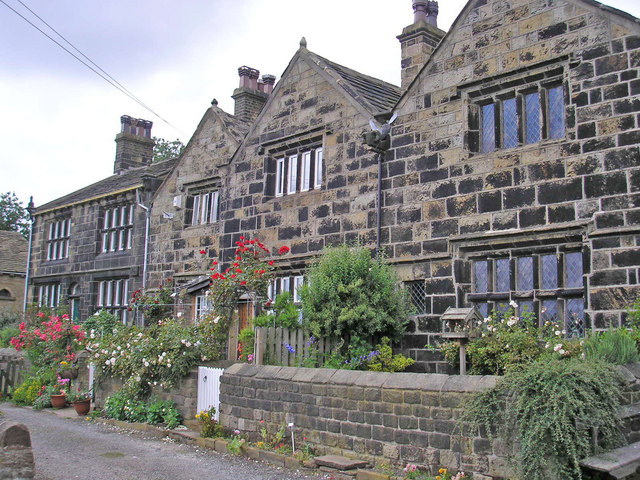
Image: © John Illingworth Taken: 16 Jul 2008
Built as a farmhouse in the early 17thC for John Ramsden. It was originally five gables, but the left hand two were partly rebuilt in 1885, by which time the house had already been subdivided. It is now four dwellings.
Images are licensed for reuse under creativecommons.org/licenses/by-sa/2.0
Image Location
Latitude
53.714551
Longitude
-1.921174