Holdenhurst: Holdenhurst Village Road
Introduction
The photograph on this page of Holdenhurst: Holdenhurst Village Road by Chris Downer as part of the Geograph project.
The Geograph project started in 2005 with the aim of publishing, organising and preserving representative images for every square kilometre of Great Britain, Ireland and the Isle of Man.

There are currently over 7.5m images from over 14,400 individuals and you can help contribute to the project by visiting https://www.geograph.org.uk
Holdenhurst: Holdenhurst Village Road
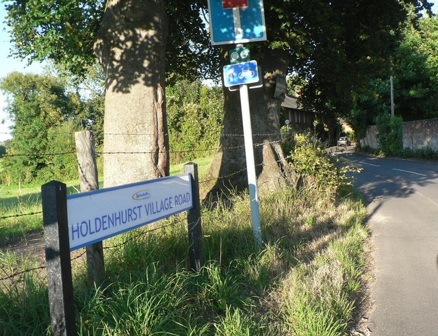
Image: © Chris Downer Taken: 15 Jul 2008
This road has recently been renamed Holdenhurst Village Road, having previously been without the 'Village'. The reason is that Holdenhurst Road, which ran from Bournemouth town centre to this point, is now cut off about a mile southwest – the section from the town is a busy, major road, whereas this part is a country lane that leads only to Holdenhurst Village. This had caused problems with motorists using satellite navigation, who found themselves in the pleasant but dead-end village, and if they were in anything large could not turn round! In the distance are Image
Images are licensed for reuse under creativecommons.org/licenses/by-sa/2.0
Image Location
Latitude
50.757356
Longitude
-1.833085