Stanmore: Royal National Orthop?dic Hospital
Introduction
The photograph on this page of Stanmore: Royal National Orthop?dic Hospital by Chris Downer as part of the Geograph project.
The Geograph project started in 2005 with the aim of publishing, organising and preserving representative images for every square kilometre of Great Britain, Ireland and the Isle of Man.

There are currently over 7.5m images from over 14,400 individuals and you can help contribute to the project by visiting https://www.geograph.org.uk
Stanmore: Royal National Orthop?dic Hospital
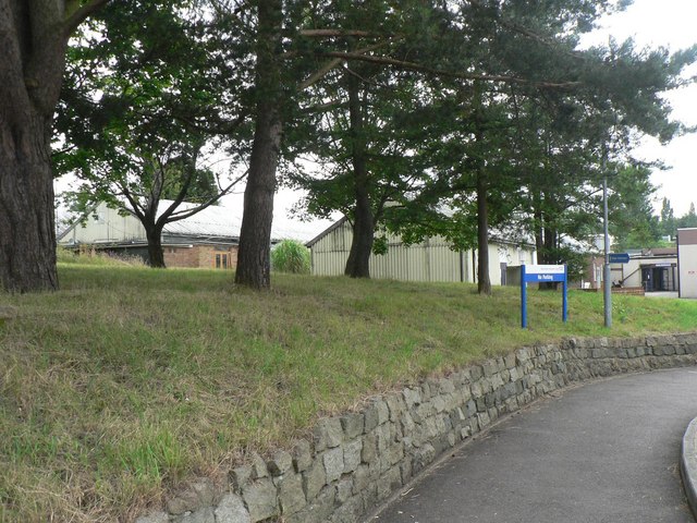
Image: © Chris Downer Taken: 15 Jul 2008
Considering that, as its name suggests, this hospital has many amputees and wheelchair users among its patients, it is not the most suitable of premises. It is a former military site, with distinctive old buildings of that ilk and a large array of prefabricated buildings. Here, we look at the main entrance and can see the ends of some of the prefab wards which are connected by a central corridor on a formidable gradient. It brings to mind the San Francisco streets portrayed in films, which are steep but level out at each frequent crossroads. These wards are even called the "Slope wards" on the map in the Outpatients waiting room. The operating theatres are at the very bottom, and one sure puts one's faith in the porters when one is being sent – literally – down! Anyhow, plans are afoot to completely rebuild the hospital nearby, and a £16-million fundraising campaign is underway.
Images are licensed for reuse under creativecommons.org/licenses/by-sa/2.0
Image Location
Latitude
51.63156
Longitude
-0.309938