Pyewipe Road Level Crossing, Gilbey Road
Introduction
The photograph on this page of Pyewipe Road Level Crossing, Gilbey Road by Alan Murray-Rust as part of the Geograph project.
The Geograph project started in 2005 with the aim of publishing, organising and preserving representative images for every square kilometre of Great Britain, Ireland and the Isle of Man.

There are currently over 7.5m images from over 14,400 individuals and you can help contribute to the project by visiting https://www.geograph.org.uk
Pyewipe Road Level Crossing, Gilbey Road
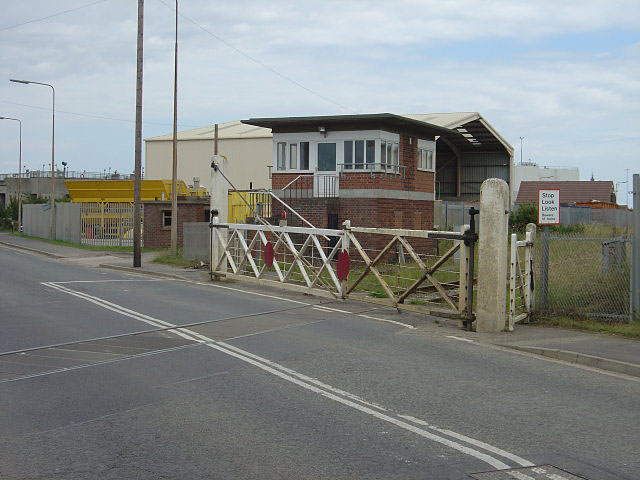
Image: © Alan Murray-Rust Taken: 13 Jul 2008
The name of the crossing is a bit confusing, as the road is certainly Gilbey Road. A fine surviving example of traditional wooden gates, and an interesting modern(ish) signal box. There does still appear to be a small amount of traffic on the railway.
Images are licensed for reuse under creativecommons.org/licenses/by-sa/2.0
Image Location


Leaflet Map data © OpenStreetMap
Latitude
53.580317
Longitude
-0.100421