Blundell Park
Introduction
The photograph on this page of Blundell Park by Alan Murray-Rust as part of the Geograph project.
The Geograph project started in 2005 with the aim of publishing, organising and preserving representative images for every square kilometre of Great Britain, Ireland and the Isle of Man.

There are currently over 7.5m images from over 14,400 individuals and you can help contribute to the project by visiting https://www.geograph.org.uk
Blundell Park
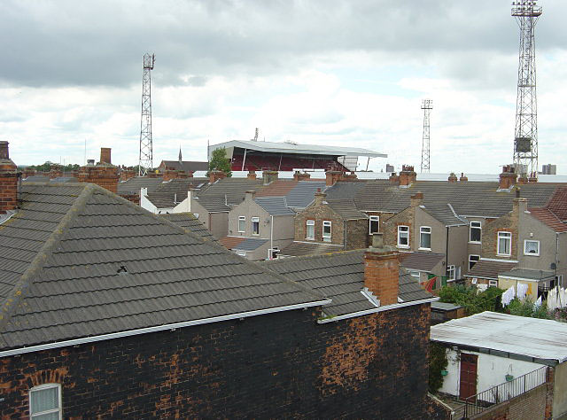
Image: © Alan Murray-Rust Taken: 13 Jul 2008
The name applies to the housing development quite as much as to the football ground - home of Grimsby Town FC. Seen from the railway footbridge at the end of Fuller Street.
Images are licensed for reuse under creativecommons.org/licenses/by-sa/2.0
Image Location
Latitude
53.569737
Longitude
-0.046376