The railway viaduct at Castleden, Dene Mouth
Introduction
The photograph on this page of The railway viaduct at Castleden, Dene Mouth by Michael Patterson as part of the Geograph project.
The Geograph project started in 2005 with the aim of publishing, organising and preserving representative images for every square kilometre of Great Britain, Ireland and the Isle of Man.

There are currently over 7.5m images from over 14,400 individuals and you can help contribute to the project by visiting https://www.geograph.org.uk
The railway viaduct at Castleden, Dene Mouth
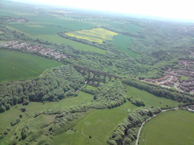
Image: © Michael Patterson Taken: 8 Jun 2008
This photograph was taken from 1200 feet above and a little to the east of the viaduct. To the left of the picture can be seen the northernmost buildings of the village of Blackhall colliery and to the right of the viaduct the southernmost buildings of Horden.
Images are licensed for reuse under creativecommons.org/licenses/by-sa/2.0
Image Location


Leaflet Map data © OpenStreetMap
Latitude
54.756973
Longitude
-1.300111