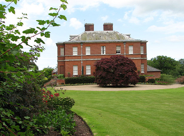
West Lodge - open garden
Introduction
The photograph on this page of West Lodge - open garden by Evelyn Simak as part of the Geograph project.
The Geograph project started in 2005 with the aim of publishing, organising and preserving representative images for every square kilometre of Great Britain, Ireland and the Isle of Man.
There are currently over 7.5m images from over 14,400 individuals and you can help contribute to the project by visiting https://www.geograph.org.uk

Image: © Evelyn Simak Taken: 13 Jul 2008
The grounds are not open to the public but on the occasion of an Open Garden charity event the public is given the opportunity to view the 9 acre gardens that surround this stately home. A survey published by the Norfolk Gardens Trust in 1997 lists a number of sites of particular historic importance, one of these being West Lodge. The Georgian House with 17th century origins is surrounded by a nine acre garden with lawns, mature trees, a rose garden, herbaceous borders, an ornamental pond and a 19th century walled kitchen garden which is still being maintained as such. Part of the property is located in the adjacent grid square to the west > http://www.geograph.org.uk/photo/882427 - http://www.geograph.org.uk/photo/882403 - http://www.geograph.org.uk/photo/882407 - http://www.geograph.org.uk/photo/882411 - http://www.geograph.org.uk/photo/882422.
Image Location


