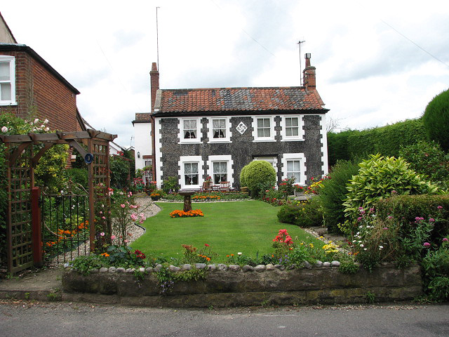
Pretty pebble flint cottages
Introduction
The photograph on this page of Pretty pebble flint cottages by Evelyn Simak as part of the Geograph project.
The Geograph project started in 2005 with the aim of publishing, organising and preserving representative images for every square kilometre of Great Britain, Ireland and the Isle of Man.
There are currently over 7.5m images from over 14,400 individuals and you can help contribute to the project by visiting https://www.geograph.org.uk

Image: © Evelyn Simak Taken: 13 Jul 2008
Numbers 3 and 5, Millgate - a pair of early 19th century cottages. Flint pebbles were used for the frontage and for creating a decorative centre panel depicting a curving swastika design. Not having experienced any disastrous 17th or 18th century fires, the medieval street pattern and many or the houses in the historical core of Aylsham have survived and there are 240 listed buildings here (accounting for 20% of all listed buildings in the district of Broadland). The Millgate area to the northeast of the town, however, was developed during the late 18th century, when the completion of the Bure navigation canal (Aylsham Navigation) brought further wealth to the town. One of the important features of Aylsham houses (and buildings in surrounding parishes) is the use of bricks for building, influenced by the nearby Blickling Hall. The development of Flemish bond brickwork and Dutch shaped gables influenced builders in the area and a cluster of early to mid 17th century brick buildings can be found within a five mile radius around Blickling, in an area where flint was the commonly used building material.
Image Location


