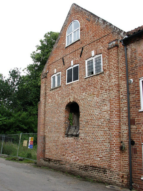
Millgate Mill - south gable end
Introduction
The photograph on this page of Millgate Mill - south gable end by Evelyn Simak as part of the Geograph project.
The Geograph project started in 2005 with the aim of publishing, organising and preserving representative images for every square kilometre of Great Britain, Ireland and the Isle of Man.
There are currently over 7.5m images from over 14,400 individuals and you can help contribute to the project by visiting https://www.geograph.org.uk

Image: © Evelyn Simak Taken: 13 Jul 2008
Bordering on Mill Row. The completion of the Bure navigation canal (Aylsham Navigation) in 1773 brought further wealth to the prosperous town and led to the development around Millgate. William White's History, Gazetteer, and Directory of Norfolk 1845 reports that "The Bure, which washes the foot of the town, was formerly only navigable from Yarmouth to Coltishall, (11 miles below Aylsham bridge by the water, and 7 by land;) but in 1773, an act was obtained for extending the navigation to Aylsham, for boats of 14 tons burthen, drawing two feet five inches water, which was completed after many difficulties and interruptions, in Oct., 1779, at a cost of upwards of £6000, including the cost of the basin and wharfs near the bridge, where much business is done in coal, corn, timber, &c." See also > http://www.norfolkmills.co.uk/aylsham-navigation.html The mill, also known as Millgate Mill, was rebuilt in 1798 but it is believed that a mill has been on the site since Domesday or before > http://www.geograph.org.uk/photo/885415 - http://www.geograph.org.uk/photo/885420. The block running parallel with Mill Row was built in the second half of the 19th century and the millpool was widened up to its walls at the same time. Unusually, the mill (which in its heyday was served by 26 wherries) has three lucums (sack hoists). On 26th August 1912 the great flood destroyed all locks and the Aylsham Navigation was closed; in 1967 the mill was vacated and in 1974 the Aylsham Canal basin was filled in. Whereas the 19th century wing has since been converted into flats, the watermill can only be viewed through a metal fence that was erected by developers - barring public access to roughly 30 square metres of land that residents believe to be common land - now neglected and overgrown with weeds - whilst the developers claim that “‘If we develop the ground floor that overlooks the green space, who would want to look out of the window if people keep walking past the front door? The village green would stop construction because of the effect on the rights of way." (Quote taken from an article by Keiron Pim, Eastern Daily Press, 9th July 2008). Due to the present impasse between residents and developers the mill has been listed as Category B (immediate risk of further rapid deterioration or loss of fabric) on the Norfolk County Council's buildings at Risk Register (Reference number NO1910) . See also: http://www.norfolkmills.co.uk/Watermills/aylsham.html

