Bridge at Shadwell Basin
Introduction
The photograph on this page of Bridge at Shadwell Basin by David Morrison as part of the Geograph project.
The Geograph project started in 2005 with the aim of publishing, organising and preserving representative images for every square kilometre of Great Britain, Ireland and the Isle of Man.

There are currently over 7.5m images from over 14,400 individuals and you can help contribute to the project by visiting https://www.geograph.org.uk
Bridge at Shadwell Basin
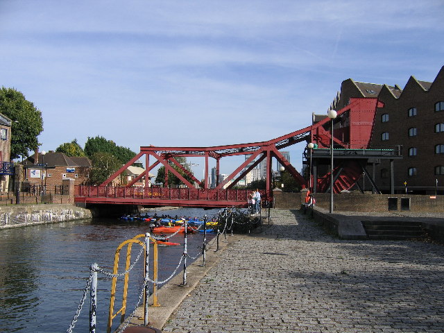
Image: © David Morrison Taken: 9 Oct 2005
This bridge spans the entrance canal to Shadwell Basin. In former times, the bridge could be lifted by pivoting at the right hand end. The basin is no longer open to the river, and is used for recreational purposes, eg, the kayaks under the bridge.
Images are licensed for reuse under creativecommons.org/licenses/by-sa/2.0
Image Location


Leaflet Map data © OpenStreetMap
Latitude
51.509015
Longitude
-0.05033