Smith's Flour Mills
Introduction
The photograph on this page of Smith's Flour Mills by John M as part of the Geograph project.
The Geograph project started in 2005 with the aim of publishing, organising and preserving representative images for every square kilometre of Great Britain, Ireland and the Isle of Man.

There are currently over 7.5m images from over 14,400 individuals and you can help contribute to the project by visiting https://www.geograph.org.uk
Smith's Flour Mills
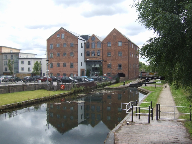
Image: © John M Taken: 13 Jul 2008
Converted to apartments as part of a new housing development beside the ring road and Walsall Branch Canal. The mill dates from 1849 and was operated by Smiths from 1900 into the 1970s.
Images are licensed for reuse under creativecommons.org/licenses/by-sa/2.0
Image Location
Latitude
52.587005
Longitude
-1.993167