St. Peter's churchyard, St Mary Bourne
Introduction
The photograph on this page of St. Peter's churchyard, St Mary Bourne by Graham Horn as part of the Geograph project.
The Geograph project started in 2005 with the aim of publishing, organising and preserving representative images for every square kilometre of Great Britain, Ireland and the Isle of Man.

There are currently over 7.5m images from over 14,400 individuals and you can help contribute to the project by visiting https://www.geograph.org.uk
St. Peter's churchyard, St Mary Bourne
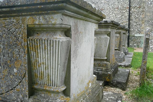
Image: © Graham Horn Taken: 12 Jul 2008
These four large graves stand immediately outside the south (main) door of the church. The consistency of size and carvings indicates they are probably all members of the same important family.
Images are licensed for reuse under creativecommons.org/licenses/by-sa/2.0
Image Location
Latitude
51.250128
Longitude
-1.395309