The Wedge, St Mary Bourne
Introduction
The photograph on this page of The Wedge, St Mary Bourne by Graham Horn as part of the Geograph project.
The Geograph project started in 2005 with the aim of publishing, organising and preserving representative images for every square kilometre of Great Britain, Ireland and the Isle of Man.

There are currently over 7.5m images from over 14,400 individuals and you can help contribute to the project by visiting https://www.geograph.org.uk
The Wedge, St Mary Bourne
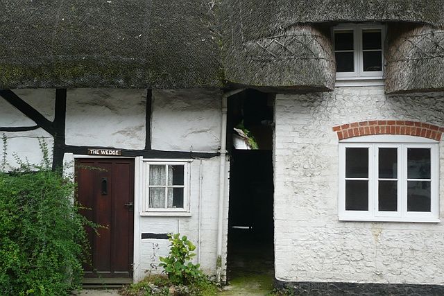
Image: © Graham Horn Taken: 12 Jul 2008
One of a tightly packed group of thatched cottages around the village centre.The narrow but widening passageway appears to lead to another house. Perhaps that is where the name "the wedge" originates.
Images are licensed for reuse under creativecommons.org/licenses/by-sa/2.0
Image Location
Latitude
51.249678
Longitude
-1.395315