Waddington Village
Introduction
The photograph on this page of Waddington Village by Paul Anderson as part of the Geograph project.
The Geograph project started in 2005 with the aim of publishing, organising and preserving representative images for every square kilometre of Great Britain, Ireland and the Isle of Man.

There are currently over 7.5m images from over 14,400 individuals and you can help contribute to the project by visiting https://www.geograph.org.uk
Waddington Village
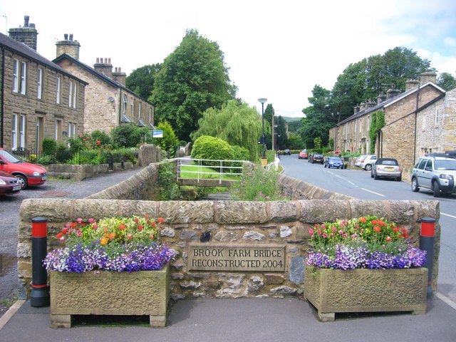
Image: © Paul Anderson Taken: 12 Jul 2008
Brook Farm Bridge in Waddington was reconstructed during June/July 2004. The opportunity was taken at that time to address problems caused by flooding this allowed increased water flow beneath the bridge after some minor realignment of the river. Image
Images are licensed for reuse under creativecommons.org/licenses/by-sa/2.0
Image Location
Latitude
53.88895
Longitude
-2.413196