(Part of) architect's drawing of Hassocks station before the vandals demolished it
Introduction
The photograph on this page of (Part of) architect's drawing of Hassocks station before the vandals demolished it by Mike Quinn as part of the Geograph project.
The Geograph project started in 2005 with the aim of publishing, organising and preserving representative images for every square kilometre of Great Britain, Ireland and the Isle of Man.

There are currently over 7.5m images from over 14,400 individuals and you can help contribute to the project by visiting https://www.geograph.org.uk
(Part of) architect's drawing of Hassocks station before the vandals demolished it
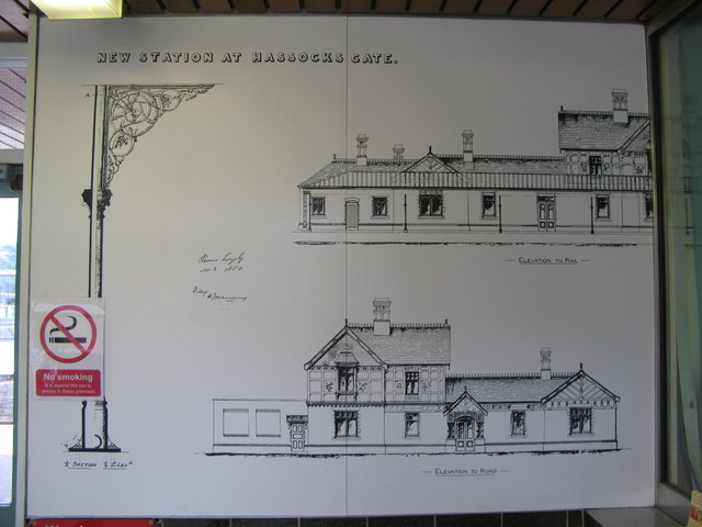
Image: © Mike Quinn Taken: 2 Jul 2008
The station, that is. This drawing, displayed in the ticket office/waiting room on Platform 1 of the current miserable cluster of bus shelters that passes for Hassocks station, shows part of the original beautiful Victorian building.
Images are licensed for reuse under creativecommons.org/licenses/by-sa/2.0
Image Location


Leaflet Map data © OpenStreetMap
Latitude
50.924584
Longitude
-0.145727