Yealmpton: Yealmpton Mills
Introduction
The photograph on this page of Yealmpton: Yealmpton Mills by Martin Bodman as part of the Geograph project.
The Geograph project started in 2005 with the aim of publishing, organising and preserving representative images for every square kilometre of Great Britain, Ireland and the Isle of Man.

There are currently over 7.5m images from over 14,400 individuals and you can help contribute to the project by visiting https://www.geograph.org.uk
Yealmpton: Yealmpton Mills
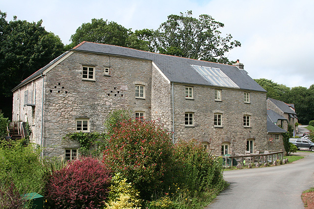
Image: © Martin Bodman Taken: 10 Jul 2008
A conversion to residential accommodation, with a further conversion – the old stable block – beyond. In 1866 the mill was offered to let: ‘.. old established and valuable Flour Mills known as the Yealmpton Mills, situated close to the village in the parish of Yealmpton, comprising three pairs of stones, driven by two water-wheels and having all necessary machinery .. for carrying on an extensive flour trade .. one mile from Kitley Quay where corn can be brought by water ..’ [Source: The Western Times 6 July 1866 p 1 col 1]. This was the lowest mill in the Yealm valley, powered by a leat from the river. A mill was known as ‘Mills’ when more than one waterwheel was employed
Images are licensed for reuse under creativecommons.org/licenses/by-sa/2.0
Image Location
Latitude
50.348094
Longitude
-3.994529