Houses on King Street, Maryport
Introduction
The photograph on this page of Houses on King Street, Maryport by Humphrey Bolton as part of the Geograph project.
The Geograph project started in 2005 with the aim of publishing, organising and preserving representative images for every square kilometre of Great Britain, Ireland and the Isle of Man.

There are currently over 7.5m images from over 14,400 individuals and you can help contribute to the project by visiting https://www.geograph.org.uk
Houses on King Street, Maryport
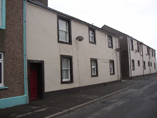
Image: © Humphrey Bolton Taken: 3 Jan 2004
King Street runs parallel to the shore, north of the harbour. These houses were probably built to let, as they each have 'CM1791 and a house no. above the door. The second door has been blocked up but the inscription is still there.
Images are licensed for reuse under creativecommons.org/licenses/by-sa/2.0
Image Location
Latitude
54.715995
Longitude
-3.501077