Meldreth: Village Stocks and Whipping Post
Introduction
The photograph on this page of Meldreth: Village Stocks and Whipping Post by Nigel Cox as part of the Geograph project.
The Geograph project started in 2005 with the aim of publishing, organising and preserving representative images for every square kilometre of Great Britain, Ireland and the Isle of Man.

There are currently over 7.5m images from over 14,400 individuals and you can help contribute to the project by visiting https://www.geograph.org.uk
Meldreth: Village Stocks and Whipping Post
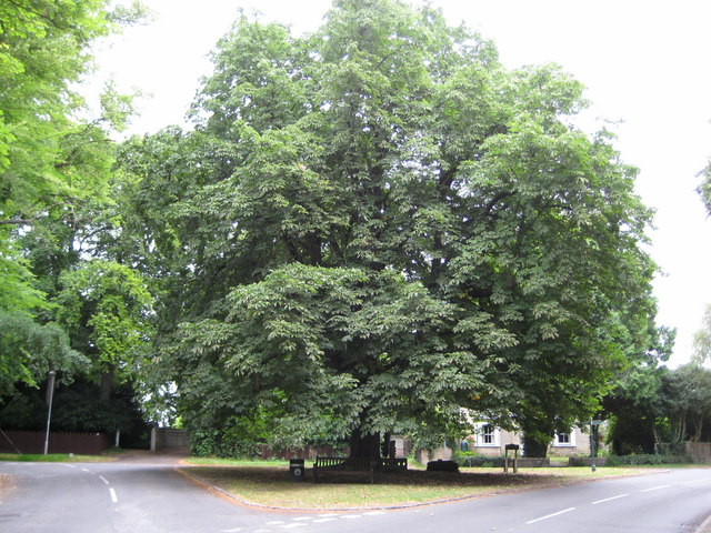
Image: © Nigel Cox Taken: 6 Jul 2008
Nearly hidden at the base of this magnificent horse chestnut tree and only just visible as four holes immediately to the right of the tree trunk are the village stocks. These are surprisingly mentioned on the Ordnance Survey 1:10,000 scale mapping along with the whipping post. The base of the whipping post can be seen just to the right of the stocks. The triangular area is known as Marvell's Green and is at the junction of three roads, the High Street, Fenny Lane and North End.
Images are licensed for reuse under creativecommons.org/licenses/by-sa/2.0
Image Location


Leaflet Map data © OpenStreetMap
Latitude
52.09939
Longitude
0.006411