
Melbourn crossroads
Introduction
The photograph on this page of Melbourn crossroads by Nigel Cox as part of the Geograph project.
The Geograph project started in 2005 with the aim of publishing, organising and preserving representative images for every square kilometre of Great Britain, Ireland and the Isle of Man.

There are currently over 7.5m images from over 14,400 individuals and you can help contribute to the project by visiting https://www.geograph.org.uk
Melbourn crossroads
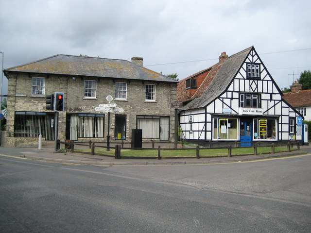
Image: © Nigel Cox Taken: 6 Jul 2008
The crossroads marks the junction of the High Street, Mortlock Street, Station Road and Cambridge Road. Prior to the building of the bypass the A10 road used to follow the High Street and Cambridge Road. On view is a 2000 Millennium direction finger post showing London 40 miles, Royston 2½; Newmarket 24, Barley 4¾; Cambridge 10, Foxton 2¾; and Whaddon 1¾, Meldreth & Railway Station ¾. There is also a Best Kept Village sign from 1991. On the very far left there is a black sign attached to the side of the brick building showing the way to the Baptist Church, and on the very far right an ancient petrol pump next to the half-timbered garage can be seen.
Images are licensed for reuse under creativecommons.org/licenses/by-sa/2.0
Image Location

Latitude
52.083487
Longitude
0.016206