The Iron Horse
Introduction
The photograph on this page of The Iron Horse by Ian Capper as part of the Geograph project.
The Geograph project started in 2005 with the aim of publishing, organising and preserving representative images for every square kilometre of Great Britain, Ireland and the Isle of Man.

There are currently over 7.5m images from over 14,400 individuals and you can help contribute to the project by visiting https://www.geograph.org.uk
The Iron Horse
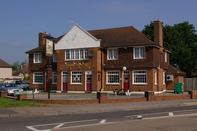
Image: © Ian Capper Taken: 8 Jun 2008
Built in the 1950s as the pub for the London overspill estate built here. The name may have been intended as a reference to the Croydon, Merstham & Godstone Iron Railway (an extension to the Surrey Iron Railway) which was built in 1805 (billed as the world's first public railway) and which (despite its name) ended at the quarries near here, rather than Godstone. If so, the pub name would be a misnomer, given that this was a horse (of the flesh and blood variety, not iron) drawn plateway. The pub has since been closed (in November 2008 - see Image for photo) and demolished (in March 2010 - see Image for photo of site).
Images are licensed for reuse under creativecommons.org/licenses/by-sa/2.0
Image Location
Latitude
51.26033
Longitude
-0.145664