
Waltham Windmill
Introduction
The photograph on this page of Waltham Windmill by Paul Glazzard as part of the Geograph project.
The Geograph project started in 2005 with the aim of publishing, organising and preserving representative images for every square kilometre of Great Britain, Ireland and the Isle of Man.

There are currently over 7.5m images from over 14,400 individuals and you can help contribute to the project by visiting https://www.geograph.org.uk
Waltham Windmill
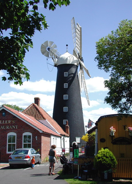
Image: © Paul Glazzard Taken: 4 Jul 2008
Six sailed, six storied tower windmill off the east side of Brigsley Road, Waltham, built in 1878-80 by John Saunderson of Louth. Used as a home guard lookout post in World War 2 and wind powered until 1962 when it was briefly converted to electricity for animal feed production. Restored and maintained by the Waltham Windmill Preservation Society since December 1966 http://www.walthamwindmill.co.uk/index.html and now occasionally used to produce flour.
Images are licensed for reuse under creativecommons.org/licenses/by-sa/2.0
Image Location

Latitude
53.511213
Longitude
-0.102156