Gyratory system
Introduction
The photograph on this page of Gyratory system by Dennis Turner as part of the Geograph project.
The Geograph project started in 2005 with the aim of publishing, organising and preserving representative images for every square kilometre of Great Britain, Ireland and the Isle of Man.

There are currently over 7.5m images from over 14,400 individuals and you can help contribute to the project by visiting https://www.geograph.org.uk
Gyratory system
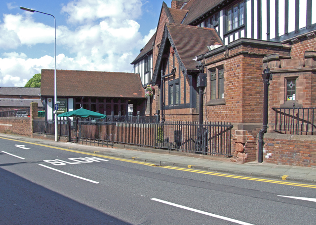
Image: © Dennis Turner Taken: 19 Jun 2008
The west elevation of the George and Dragon forms part of the gyratory road system. The George and Dragon is on an island round which traffic gyrates. Road in foreground is northbound Parkgate Road. Left of the picture is the public house car park and the building of a motor cycle dealer.
Images are licensed for reuse under creativecommons.org/licenses/by-sa/2.0
Image Location
Latitude
53.196713
Longitude
-2.895087