Barge on the Trent approaching Holme Lock
Introduction
The photograph on this page of Barge on the Trent approaching Holme Lock by Tim Heaton as part of the Geograph project.
The Geograph project started in 2005 with the aim of publishing, organising and preserving representative images for every square kilometre of Great Britain, Ireland and the Isle of Man.

There are currently over 7.5m images from over 14,400 individuals and you can help contribute to the project by visiting https://www.geograph.org.uk
Barge on the Trent approaching Holme Lock
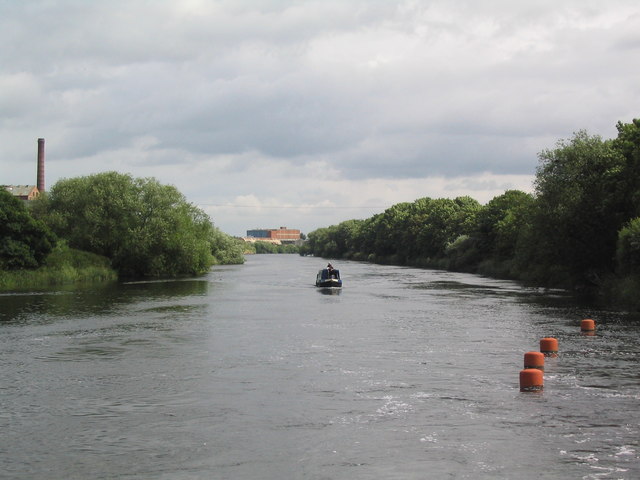
Image: © Tim Heaton Taken: 29 Jun 2008
The chimney on the left is part of the derelict Colwick sugar factory. The buoys on the right mark the exit of strong currents from the Holme Pierrepont white water course.
Images are licensed for reuse under creativecommons.org/licenses/by-sa/2.0
Image Location
Latitude
52.948625
Longitude
-1.083172