Signs at Junction of A281 and Nuthurst Road, Monks Gate, West Sussex.
Introduction
The photograph on this page of Signs at Junction of A281 and Nuthurst Road, Monks Gate, West Sussex. by Pete Chapman as part of the Geograph project.
The Geograph project started in 2005 with the aim of publishing, organising and preserving representative images for every square kilometre of Great Britain, Ireland and the Isle of Man.

There are currently over 7.5m images from over 14,400 individuals and you can help contribute to the project by visiting https://www.geograph.org.uk
Signs at Junction of A281 and Nuthurst Road, Monks Gate, West Sussex.
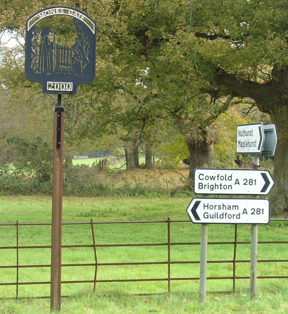
Image: © Pete Chapman Taken: 30 Nov 2005
Standard ministry of transport style direction signs. The village sign is just to the left of the direction sign cluster. Several villages in this area have this style sign. The sign takes the form of a black metal sheet with a fretwork type silhouette of an appropriate scene, in this case a hooded monk and a gate. The village name is painted white across the top of the sign, with the year (2000) also in white across the bottom. The signs were a millennium project.
Images are licensed for reuse under creativecommons.org/licenses/by-sa/2.0
Image Location


Leaflet Map data © OpenStreetMap
Latitude
51.03428
Longitude
-0.28569