Chelsea: Harbour Yard
Introduction
The photograph on this page of Chelsea: Harbour Yard by Nigel Cox as part of the Geograph project.
The Geograph project started in 2005 with the aim of publishing, organising and preserving representative images for every square kilometre of Great Britain, Ireland and the Isle of Man.

There are currently over 7.5m images from over 14,400 individuals and you can help contribute to the project by visiting https://www.geograph.org.uk
Chelsea: Harbour Yard
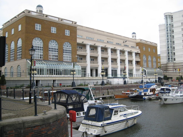
Image: © Nigel Cox Taken: 22 Jun 2008
The Harbour Yard is an office block in the Chelsea Harbour development http://www.chelseaharbouroffices.co.uk/default.asp overlooking the marina. The walls of the marina here are the original Victorian dock walls. In all the old Ordnance Survey maps of this area, up to and including the 1938 Edition, the location where the Harbour Yard building is now was just a mass of dockyard railway sidings.
Images are licensed for reuse under creativecommons.org/licenses/by-sa/2.0
Image Location


Leaflet Map data © OpenStreetMap
Latitude
51.47515
Longitude
-0.181375