The Old Post Office
Introduction
The photograph on this page of The Old Post Office by Evelyn Simak as part of the Geograph project.
The Geograph project started in 2005 with the aim of publishing, organising and preserving representative images for every square kilometre of Great Britain, Ireland and the Isle of Man.

There are currently over 7.5m images from over 14,400 individuals and you can help contribute to the project by visiting https://www.geograph.org.uk
The Old Post Office
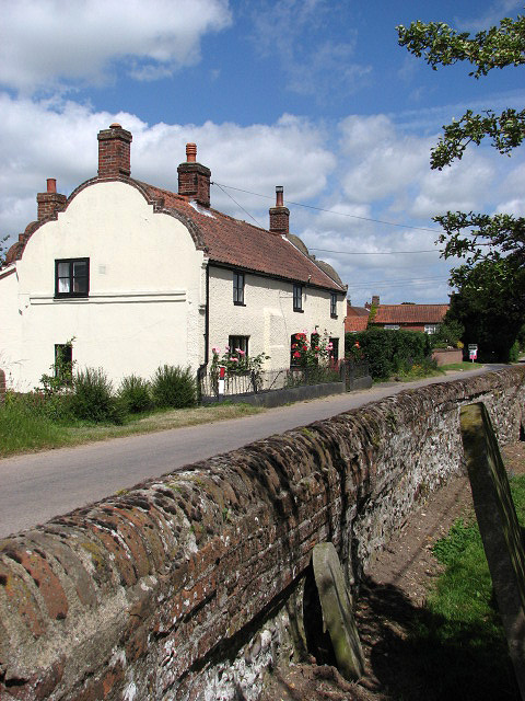
Image: © Evelyn Simak Taken: 26 Jun 2008
On Norwich Road, opposite the church of SS Peter and Paul > http://www.geograph.org.uk/photo/861761. The view was taken from the churchyard. The cottage dates from c. 1725; it used to be a public house and became a Post Office in 1883. It is now a private dwelling house. This information was obtained from a leaflet that is available - in context with a wall hanging > http://www.geograph.org.uk/photo/861810 made by ladies of the village - in the church of SS Peter and Paul. There no longer is a post office in the village of Tuttington.
Images are licensed for reuse under creativecommons.org/licenses/by-sa/2.0
Image Location
Latitude
52.79615
Longitude
1.30005