Macduff Lifeboat
Introduction
The photograph on this page of Macduff Lifeboat by Anne Burgess as part of the Geograph project.
The Geograph project started in 2005 with the aim of publishing, organising and preserving representative images for every square kilometre of Great Britain, Ireland and the Isle of Man.

There are currently over 7.5m images from over 14,400 individuals and you can help contribute to the project by visiting https://www.geograph.org.uk
Macduff Lifeboat
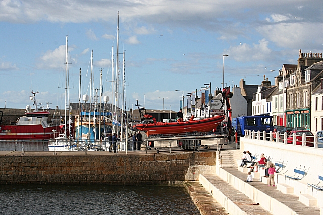
Image: © Anne Burgess Taken: 26 Jun 2008
The wall divides the inner harbour beyond from the outer harbour. The lifeboat is being unloaded from its lorry to give a demonstration as part of the run-up to the yacht race to Stavanger. Shore Street is on the right.
Images are licensed for reuse under creativecommons.org/licenses/by-sa/2.0
Image Location


Leaflet Map data © OpenStreetMap
Latitude
57.670472
Longitude
-2.498036