Pershore: The Almonry
Introduction
The photograph on this page of Pershore: The Almonry by Nigel Cox as part of the Geograph project.
The Geograph project started in 2005 with the aim of publishing, organising and preserving representative images for every square kilometre of Great Britain, Ireland and the Isle of Man.

There are currently over 7.5m images from over 14,400 individuals and you can help contribute to the project by visiting https://www.geograph.org.uk
Pershore: The Almonry
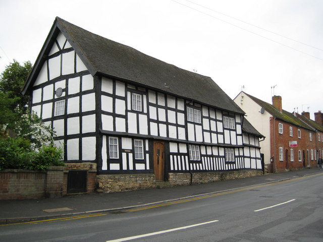
Image: © Nigel Cox Taken: 21 Jun 2008
Historically an almonry was a house where an almoner dispensed his or her alms, and this building's proximity to the Abbey means it was probably built on the site where the monks housed their visitors and dispensed charity to the poor. The half-timbered structure has been restored by the Worcestershire Historic Buildings Preservation Trust, as evidenced by the grey-blue plaque in the gable end, and is a private residence. Digital cameras often produce alarming vertical lines in buildings making them not look 'right', but this building genuinely is severely distorted. As a guide the only truly vertical line in the building is defined by the inset wooden front door.
Images are licensed for reuse under creativecommons.org/licenses/by-sa/2.0
Image Location


Leaflet Map data © OpenStreetMap
Latitude
52.110499
Longitude
-2.080266