Charminster: postbox № BH9 143, Fitzharris Avenue
Introduction
The photograph on this page of Charminster: postbox № BH9 143, Fitzharris Avenue by Chris Downer as part of the Geograph project.
The Geograph project started in 2005 with the aim of publishing, organising and preserving representative images for every square kilometre of Great Britain, Ireland and the Isle of Man.

There are currently over 7.5m images from over 14,400 individuals and you can help contribute to the project by visiting https://www.geograph.org.uk
Charminster: postbox № BH9 143, Fitzharris Avenue
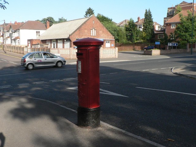
Image: © Chris Downer Taken: 25 Jun 2008
An Edward VII-reign postbox on the corner of Fitzharris Avenue (behind camera) and Charminster Road. In the background is Image Charminster Road is the boundary of BH8 and BH9 – if the postbox had been just around the corner it would have a BH8 number.
Images are licensed for reuse under creativecommons.org/licenses/by-sa/2.0
Image Location
Latitude
50.738872
Longitude
-1.864186