Brockham Pound
Introduction
The photograph on this page of Brockham Pound by Hugh Craddock as part of the Geograph project.
The Geograph project started in 2005 with the aim of publishing, organising and preserving representative images for every square kilometre of Great Britain, Ireland and the Isle of Man.

There are currently over 7.5m images from over 14,400 individuals and you can help contribute to the project by visiting https://www.geograph.org.uk
Brockham Pound
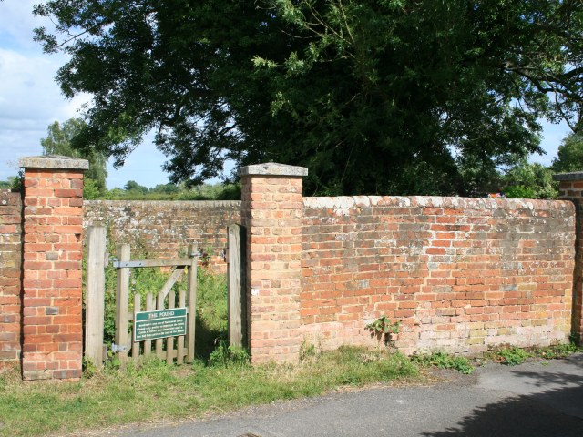
Image: © Hugh Craddock Taken: 22 Jun 2008
The pound lies at the eastern end of a minor road running east from the green, itself known as Brockham Green. The sign on the gate reads: "The Pound. Brockham's own Act of Parliament (1812) allowed only poultry to depasture the Green. Cattle or horses were impounded until a fine had been paid to the Lord of the Manor." The Act would have been the Brockham and East Betchworth (Surrey) Inclosure Act 1812, which parcelled up and inclosed the common fields and common land in the surrounding area, but left intact the common land in the village centre, which had long since become the green.
Images are licensed for reuse under creativecommons.org/licenses/by-sa/2.0
Image Location


Leaflet Map data © OpenStreetMap
Latitude
51.232737
Longitude
-0.284628