Middle Blagdon
Introduction
The photograph on this page of Middle Blagdon by Derek Harper as part of the Geograph project.
The Geograph project started in 2005 with the aim of publishing, organising and preserving representative images for every square kilometre of Great Britain, Ireland and the Isle of Man.

There are currently over 7.5m images from over 14,400 individuals and you can help contribute to the project by visiting https://www.geograph.org.uk
Middle Blagdon
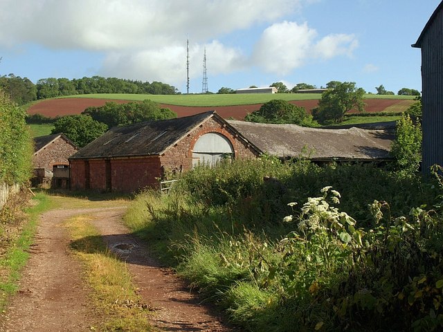
Image: © Derek Harper Taken: 19 Jun 2008
Another part of the extensive range of farm buildings seen in Image, this time from Middle Blagdon Lane. "A rare example in Devon of a large-scale split-level Victorian farmyard, still in agricultural use, and relatively unaltered" https://historicengland.org.uk/listing/the-list/list-entry/1207438 .
Images are licensed for reuse under creativecommons.org/licenses/by-sa/2.0
Image Location
Latitude
50.437423
Longitude
-3.61045