Pleasley Mills
Introduction
The photograph on this page of Pleasley Mills by Alan Murray-Rust as part of the Geograph project.
The Geograph project started in 2005 with the aim of publishing, organising and preserving representative images for every square kilometre of Great Britain, Ireland and the Isle of Man.

There are currently over 7.5m images from over 14,400 individuals and you can help contribute to the project by visiting https://www.geograph.org.uk
Pleasley Mills
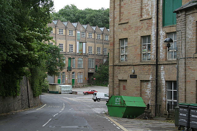
Image: © Alan Murray-Rust Taken: 22 Jun 2008
Three phases of construction can be seen in this view. The nearest building is part of the original water mill. The more distant building consists of two phases. The first two storeys were built in 1913, with the upper storeys being added probably in the 1930s.
Images are licensed for reuse under creativecommons.org/licenses/by-sa/2.0
Image Location
Latitude
53.178696
Longitude
-1.227303