Threlkeld C of E Primary School
Introduction
The photograph on this page of Threlkeld C of E Primary School by Ian Capper as part of the Geograph project.
The Geograph project started in 2005 with the aim of publishing, organising and preserving representative images for every square kilometre of Great Britain, Ireland and the Isle of Man.

There are currently over 7.5m images from over 14,400 individuals and you can help contribute to the project by visiting https://www.geograph.org.uk
Threlkeld C of E Primary School
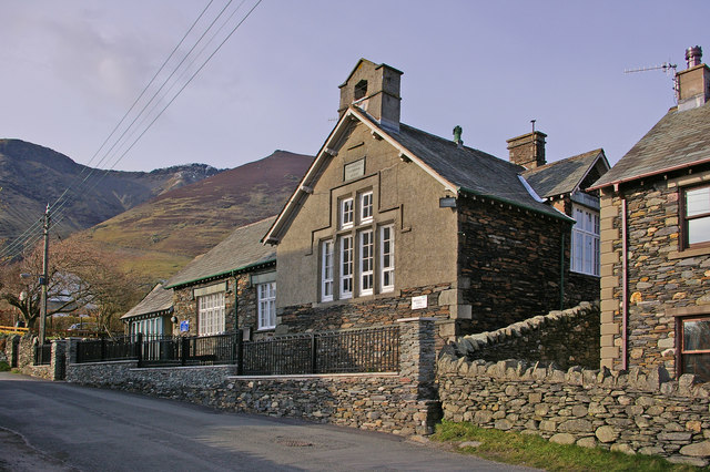
Image: © Ian Capper Taken: 8 Apr 2008
Until 1776 village children were taught in the chancel of the church (see Image). However, when this was demolished, a school house was built in Blease Road for boys only (see Image). In 1842 an upper floor was added for girls. In 1849 the school moved across the road to the new buildings shown here.
Images are licensed for reuse under creativecommons.org/licenses/by-sa/2.0
Image Location
Latitude
54.619382
Longitude
-3.055465