Speyside Way at Auchenreath
Introduction
The photograph on this page of Speyside Way at Auchenreath by Anne Burgess as part of the Geograph project.
The Geograph project started in 2005 with the aim of publishing, organising and preserving representative images for every square kilometre of Great Britain, Ireland and the Isle of Man.

There are currently over 7.5m images from over 14,400 individuals and you can help contribute to the project by visiting https://www.geograph.org.uk
Speyside Way at Auchenreath
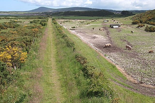
Image: © Anne Burgess Taken: 20 Jun 2008
A field of pigs beside the path. The undulating ridges and stony ground reveal that this land east of the River Spey is formed of shingle ridges like the Sea of Stones. This section of the Speyside Way follows the arrow-straight line of the former Great North of Scotland Railway. The official Speyside Way web site at http://www.speysideway.co.uk has more information.
Images are licensed for reuse under creativecommons.org/licenses/by-sa/2.0
Image Location


Leaflet Map data © OpenStreetMap
Latitude
57.662236
Longitude
-3.05102