Potwell Dyke Grasslands
Introduction
The photograph on this page of Potwell Dyke Grasslands by Alan Murray-Rust as part of the Geograph project.
The Geograph project started in 2005 with the aim of publishing, organising and preserving representative images for every square kilometre of Great Britain, Ireland and the Isle of Man.

There are currently over 7.5m images from over 14,400 individuals and you can help contribute to the project by visiting https://www.geograph.org.uk
Potwell Dyke Grasslands
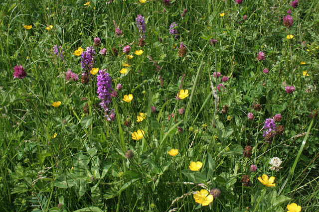
Image: © Alan Murray-Rust Taken: 19 Jun 2008
This is a group of small fields owned by the Minster, now being managed as traditional hay-meadows. There is a wealth of meadow flowers, with some variety due to different habitats. This corner is low and damp and has a thriving population of Southern Marsh Orchid. Also visible here are Buttercup and Red and White Clover.
Images are licensed for reuse under creativecommons.org/licenses/by-sa/2.0
Image Location
Latitude
53.07411
Longitude
-0.951544