
View from the top deck-13
Introduction
The photograph on this page of View from the top deck-13 by David Long as part of the Geograph project.
The Geograph project started in 2005 with the aim of publishing, organising and preserving representative images for every square kilometre of Great Britain, Ireland and the Isle of Man.

There are currently over 7.5m images from over 14,400 individuals and you can help contribute to the project by visiting https://www.geograph.org.uk
View from the top deck-13
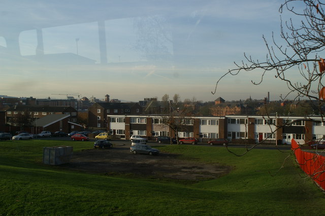
Image: © David Long Taken: 15 Nov 2007
Looking down over Wigan from Scholes. The red fence surrounds the multi-storey block. In the 1970s, after the clearance of the terraced houses, a large council estate was built on each side of Scholes. Maisonettes were a prominent feature - nick-named rabbit warrens or upside-down houses because the front door might be at the top, bottom, or middle of a two- or three-floor house. Many have since been replaced with new housing - but some, as here, have simply been demolished and the land left undeveloped. Old mines under the area makes development expensive. In the background, left to right, the new Grand Arcade, the tower of the new Market and The Galleries shopping centre, the Quality Inn, and the chimney of Pagefield Mill, now part of Wigan College.
Images are licensed for reuse under creativecommons.org/licenses/by-sa/2.0
Image Location

Latitude
53.547301
Longitude
-2.622809