Huddersfield Narrow Canal
Introduction
The photograph on this page of Huddersfield Narrow Canal by Dr Neil Clifton as part of the Geograph project.
The Geograph project started in 2005 with the aim of publishing, organising and preserving representative images for every square kilometre of Great Britain, Ireland and the Isle of Man.

There are currently over 7.5m images from over 14,400 individuals and you can help contribute to the project by visiting https://www.geograph.org.uk
Huddersfield Narrow Canal
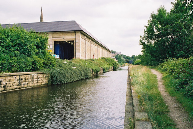
Image: © Dr Neil Clifton Taken: 7 Jul 2003
At the time of my visit part of the towpath in central Huddersfield was closed for temporary repairs, and this view looking east from the A62 bridge (Longroyd Bridge) shows part of the closed section. The spire of St. Thomas's Church is just visible in the background.
Images are licensed for reuse under creativecommons.org/licenses/by-sa/2.0
Image Location
Latitude
53.641597
Longitude
-1.794254