Church of St Nicholas, South Ferriby, from the Viking Way
Introduction
The photograph on this page of Church of St Nicholas, South Ferriby, from the Viking Way by Tim Heaton as part of the Geograph project.
The Geograph project started in 2005 with the aim of publishing, organising and preserving representative images for every square kilometre of Great Britain, Ireland and the Isle of Man.

There are currently over 7.5m images from over 14,400 individuals and you can help contribute to the project by visiting https://www.geograph.org.uk
Church of St Nicholas, South Ferriby, from the Viking Way
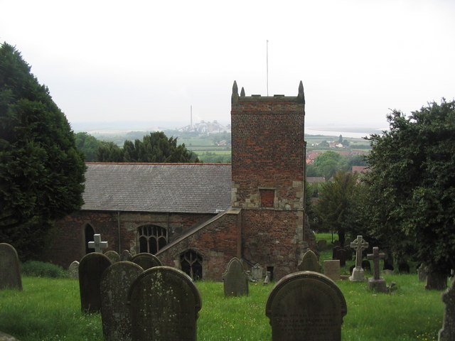
Image: © Tim Heaton Taken: 2 Jun 2008
Of Norman origins, and sited on the west-facing slope of the Lincolnshire Wolds where they meet the Humber. Because of its position on this slope, the church is aligned north-south rather than the usual east-west. The Cemex (formerly Rugby) cement works are to the left of the tower in the distance.
Images are licensed for reuse under creativecommons.org/licenses/by-sa/2.0
Image Location
Latitude
53.674876
Longitude
-0.50554