Arkleston junction
Introduction
The photograph on this page of Arkleston junction by Thomas Nugent as part of the Geograph project.
The Geograph project started in 2005 with the aim of publishing, organising and preserving representative images for every square kilometre of Great Britain, Ireland and the Isle of Man.

There are currently over 7.5m images from over 14,400 individuals and you can help contribute to the project by visiting https://www.geograph.org.uk
Arkleston junction
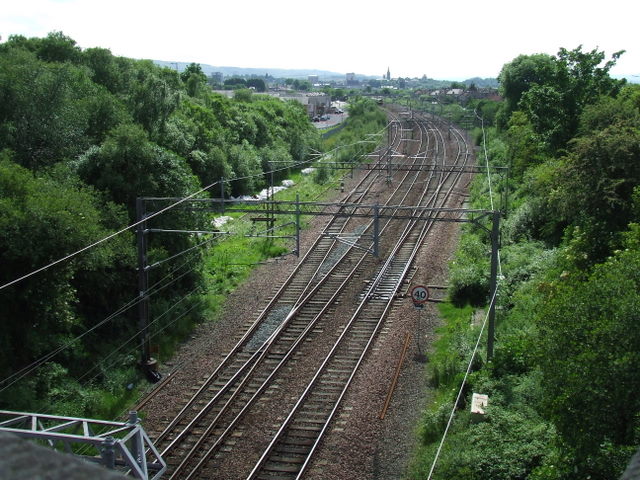
Image: © Thomas Nugent Taken: 8 Jun 2008
Viewed from Arkleston Road overbridge. The outer tracks are passing loops which are used by the coal trains which ply daily between Hunterston and the east coast. The disused line to Renfrew used to branch off in the right distance. There are some rarely used sidings amongst the bushes to the left (these were removed in early 2012).
Images are licensed for reuse under creativecommons.org/licenses/by-sa/2.0
Image Location
Latitude
55.854091
Longitude
-4.401502