Plaque, New Bann Bridge. Portadown
Introduction
The photograph on this page of Plaque, New Bann Bridge. Portadown by P Flannagan as part of the Geograph project.
The Geograph project started in 2005 with the aim of publishing, organising and preserving representative images for every square kilometre of Great Britain, Ireland and the Isle of Man.

There are currently over 7.5m images from over 14,400 individuals and you can help contribute to the project by visiting https://www.geograph.org.uk
Plaque, New Bann Bridge. Portadown
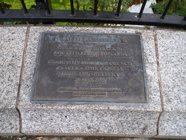
Image: © P Flannagan Taken: 14 Jun 2008
During the construction of the widening of the Bann bridge in 2005, an air raid shelter was exposed and this plaque has been placed as a reminder of the shelter.
Images are licensed for reuse under creativecommons.org/licenses/by-sa/2.0
Image Location
Latitude
54.4251
Longitude
-6.439709