Dairy farming below Blaze Fell
Introduction
The photograph on this page of Dairy farming below Blaze Fell by Richard Webb as part of the Geograph project.
The Geograph project started in 2005 with the aim of publishing, organising and preserving representative images for every square kilometre of Great Britain, Ireland and the Isle of Man.

There are currently over 7.5m images from over 14,400 individuals and you can help contribute to the project by visiting https://www.geograph.org.uk
Dairy farming below Blaze Fell
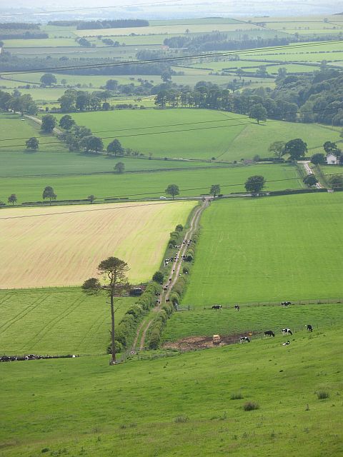
Image: © Richard Webb Taken: 9 Jun 2008
All that greenery means milk. The light coloured field has had a silage crop taken off it. Once the grass has grown back a bit, the cows will be let back in.
Images are licensed for reuse under creativecommons.org/licenses/by-sa/2.0
Image Location
Latitude
54.779622
Longitude
-2.800654